
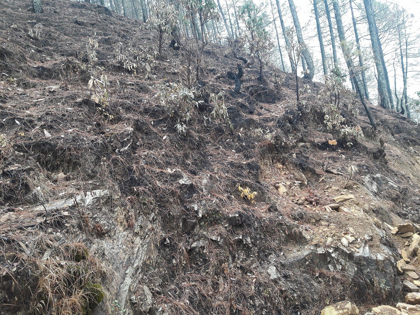
India’s forest fires
Every reading against its published limit. Every gap named.
1 February to 15 June
PERIODIC — an annual assessment, not a feed
34,562km²
burnt in one fire season · November 2023 to June 2024
4.55% of India’s forest and scrub
No legal threshold. No statute publishes a permitted number of fires or detections, so nothing here can be "over the limit". Every other situation on this site reads against a published limit; this one cannot, and says so instead of inventing a benchmark.
Forest Survey of India, Ministry of Environment, Forest and Climate Change, Table 4.19 — State/UT wise Burnt Area. What a fire even is.
What that area is, in things you know
34,562 square kilometres is a little over twenty-three times the area of Delhi, burnt in a single season between November and June. It is not a satellite alert count. It is an area, mapped afterwards from Landsat imagery by India’s own Forest Survey.
And it is measured against a country where 28.0% of the forest and scrub is already classed as highly, very highly or extremely fire prone — 2,12,290.13 square kilometres of it.
Nobody publishes a count of forest fires in India. What is published is an area burnt, and separately how many hot pixels three different satellites saw. Those are three different numbers, and none of them is the number of fires.
What it costs
11 people are recorded as having died in a forest fire in India, in a period the country mapped 34,562 square kilometres of burnt forest. Both figures are official.
11
deaths recorded as forest fire, India, 2024
Up from 6 the year before, but still the smallest named cause but one in India’s whole table of deaths from forces of nature. Avalanche killed 6.
34,562km²
of forest burnt in the same window
November 2023 to June 2024. Mapped from satellite imagery by the Forest Survey of India, state by state.
Counted or measuredModelled
The two numbers are not in conflict; they measure different things, and the gap is the point. A forest fire in India mostly does not kill people directly. It removes what the people nearby live on, and no national table counts that.
The periods differ. NCRB counts a calendar year; FSI’s fire season runs November to June. Any comparison between them is approximate, which is why it is drawn as a comparison of magnitudes and never as a rate.
Where it burnt, November 2023 to June 2024
The six worst states account for 22,813 km² of the 34,562 km² total. Delhi burnt nothing at all — which is why this is the one situation on this site that is not about Delhi.
There is no published count of people displaced, livelihoods lost or livestock killed by forest fire in India. A forest fire here mostly does not kill people directly — it removes what the people nearby live on, and no national table counts that.
What a fire even is
Three satellites looked at the same five days over the same country and returned three different numbers. Almost every fire figure in circulation depends on which one was asked, and almost none of them says.
The same box, the same 5 days to 2026-10-23, three instruments:
DO NOT SUM THESE ROWS. Three sensors, the same five days, the same box, three different counts. Published separately and never summed: S-NPP and NOAA-20 see the same fires from different orbits, and MODIS at 1 km mostly does not see a small fire at all.
The season is shut. A low count here is the calendar, not an absence of risk.
What FIRMS actually measures
A pixel hot enough to register in the infrared. Over India in March that is forest canopy, wheat and sugarcane residue, brick kilns, gas flares and rubbish fires — and the satellite cannot tell them apart.
One fire can produce several detections on one pass and none on the next. A fire the size of a football pitch is invisible to a 1 km MODIS pixel and obvious to a 375 m VIIRS one. So a detection count is a measure of what was visible to that instrument on those overpasses, and nothing more.
This is NOT a count of forest fires, and not a count of fires. It is a count of detections: pixels hot enough to register. One fire can produce several detections on one pass and none on the next, and a detection can be a field, a kiln or a rubbish heap.
A detection is an event in a pixel. A burnt area is an extent, mapped afterwards from Landsat using differenced burn ratios. This is the forest-specific measurement that a FIRMS detection count is not, and it is made by the agency with the legal mandate.
So the hero figure on this page is an area from India’s own Forest Survey, not a count from a satellite feed. The detections are kept for the one thing they are uniquely good at: showing how unstable any single fire number is.
What FSI has that nobody else does. It runs India’s forest fire alert system, and in the 2023-2024 season it sent 112.67 lakh SMS alerts — 1,12,67,000 messages — to 3,07,137 subscribers, up from 1,31,102 three seasons earlier.
Table 4.14 — Forest Cover and Scrub in Different Fire Prone Classes
28.0% of India’s forest cover and scrub sits in the top three classes. 1.45 + 9.89 + 16.63. Computed from the report's own column, not quoted from it. The total assessed is 7,58,965 km².
Sources. Burnt area and fire-prone classes: India State of Forest Report 2023, Volume 1. Detections: NASA FIRMS, VIIRS_SNPP_SP. Deaths: Accidental Deaths & Suicides in India 2024.
Fourteen seasons
The same ten days of March, every year from 2013 to 2026, on one satellite. Comparable by construction, and a sample rather than a season.
A fixed ten-day window in the same month each year, so the series does not chase the peak.
Detections in 21-30 March, VIIRS S-NPP (science quality). Peak 1,78,058 in 2021, floor 65,208 in 2024 — a spread of 2.7× between two years, on the same instrument in the same ten days.
And across the whole period it is close to flat. 2013–2020 averaged 1,12,001 detections in the window; 2021–2026 averaged 1,04,962. The year-to-year swing is far larger than any drift between the halves, which is what you would expect from something driven by how dry a particular March happened to be.
A fixed window is a SAMPLE, not a season total, and it can miss a peak. That is the trade: the same ten days every year are comparable to each other, and to nothing else. The series is VIIRS S-NPP science-quality throughout. March 2013-2026 sits inside that sensor's archive window, so the series never switches processing level.
Every window, and why the series runs on one sensor
FRP is fire radiative power in megawatts — roughly, how hard the fires were burning, as opposed to how many were seen. It is published because a season with fewer, fiercer fires and one with many small ones give the same detection count.
The series is VIIRS S-NPP science-quality throughout. March 2013-2026 sits inside that sensor's archive window, so the series never switches processing level.
And the forest itself
Fire is one way a forest disappears. This is the measurement of the disappearing, and it has roughly doubled.
2.43M ha
of tree cover lost, 2001–2025
24,257 km², measured from Landsat at 30% canopy density. That is roughly 3.4% of India’s recorded forest cover, over twenty-five years.
93.7%
of that loss was not in a planted forest
The share of measured tree-cover loss that was NOT inside a planted forest. It is the answer to the commonest objection to this series — that it merely counts plantation harvests, which grow back. On this measurement the objection does not hold: nearly all of it is outside plantations.
Tree cover lost per year, 2001–2025
It has roughly doubled. 2001–2013 lost an average of 65,162 hectares a year. 2014–2025 lost 1,31,545 — 2.0× as much. The worst single year is 2017, at 1,79,260 hectares.
Of the whole total, 15.3% was primary forest — 0.37 million hectares of loss inside forest mapped as regional primary forest in 2001 — mature natural forest, the part that does not come back on a human timescale.
And India’s own report says forest cover went up. Over its last two assessments the Forest Survey of India recorded a net national increase of 156.4 km². Both figures are official, both are honest, and they measure different things. That argument has its own page.
Tree cover loss is not deforestation. It counts canopy disappearing for any reason — felling, fire, storm, disease, harvest — and it does not say why.
Tree cover loss is not attributed to fire. Loss is counted for any cause and the dataset does not say why. Separating fire-driven loss from felling, storm and harvest needs an attribution layer the dataset does not carry — so the two measurements sit side by side and no arrow is drawn between them.
What is being said
The register — what was published about India’s forest fires, and by whom.
100 items from 40 publishers. Reporting is tagged as reporting. A headline is evidence that something was said, never that it is true.
Read the 40 most recent items
- New study maps India’s diverging fire regimesMongabay India · 21 Oct 2026
- Wildfire Map Spotlight: Henderson Fire, CaliforniaIQAir · 20 Oct 2026
- Goa braces for forest fire threat, early warning system in worksThe Times of India · 21 Oct 2026
- Women lead the fight against Uttarakhand’s forest firesEco-Business · 13 Oct 2026
- India Forest Fires 2026: Why Are They Getting Worse?Frontline Magazine · 07 Jul 2026
- Manipur recorded around 6,000 forest fire incidents last year: OfficialIndia Today NE · 09 Oct 2026
- Student protests erupt in Indonesia over rising living costs and forest fires; 9,500 security personnel deployedOpIndia · 21 Oct 2026
- Mizoram wildfire hotspots: Geospatial science predicts forest fires before they startIndia Water Portal · 06 Aug 2026
- Women shoulder the burden of expanding wildfires in rural Indianews - Mongabay · 02 Oct 2026
- House panel calls for new satellite to monitor forest fires in Himalayan regionThe Indian Express · 08 Aug 2026
- Rajya Sabha panel flags ‘knowledge gap’ on climate change’s role in Himalayan forest firesThePrint · 07 Aug 2026
- Wildfire Map Spotlight: Indonesia forest and peatland firesIQAir · 01 Oct 2026
- Knowledge Nugget | Forest fires — What Parliamentary committee flags and what more you should knowThe Indian Express · 14 Aug 2026
- Rising temperatures, not just human activity, drives Himalayan forest firesMongabay India · 25 Jun 2026
- Wildfire Map Spotlight: Dome Fire, Yosemite National Park, CaliforniaIQAir · 14 Oct 2026
- Wildfire Map Spotlight: Sand Creek and Bobcat Lakes Fires, MontanaIQAir · 03 Oct 2026
- Wildfire Map Spotlight: Three Queens and King Fires, WashingtonIQAir · 11 Oct 2026
- Wildfire Map Spotlight: Widemouth 2 Fire, UtahIQAir · 01 Oct 2026
- Wildfire Map Spotlight: Aspen Acres Fire, ColoradoIQAir · 15 Sep 2026
- Wildfire Map Spotlight: Fontainebleau Forest Fire, FranceIQAir · 14 Jul 2026
- Wildfire Map Spotlight: Snyder, Babylon, Ferris, and Gold Mountain Fires in Colorado and UtahIQAir · 06 Sep 2026
- When wildfires make their own weather: As France sees its first fire cloud, should India be worried?The Times of India · 04 Aug 2026
- Wildfire Map Spotlight: Ross Fire, TexasIQAir · 17 Sep 2026
- Europe’s Wildfires: Why They’re Growing Bigger, Hotter and Harder to Control ExplainedVajiram & Ravi · 04 Aug 2026
- Why Europe’s wildfires are getting bigger, hotter and harder to stopThe Indian Express · 02 Aug 2026
- Panel flags forest fire tracking gaps, seeks 24x7 satellite monitoring across IndiaTelegraph India · 09 Aug 2026
- Why Fire Suppression Persists: Territorial Politics and the Criminalisation of Fire in India's Political ForestsWiley Online Library · 06 Aug 2026
- How a village in Bastar is stopping forest firesMongabay India · 10 Sep 2026
- Indian Army, IAF contain major forest fire in Himachal’s Kasauli slopesThe Hindu · 27 May 2026
- iNDIAN ARMY'S JOINT EFFORTS CONTAIN KASAULI FOREST FIREPress Information Bureau · 27 May 2026
- Fire scorched 42.2 per cent of Telangana’s forests in two yearsThe New Indian Express · 11 Aug 2026
- Uttarakhand to study rising wildfire threat to high-altitude ecosystemsThe New Indian Express · 06 Sep 2026
- Uttarakhand recorded 375 forest fires in past three months; Chamoli worst hitThe Hindu · 26 May 2026
- Forest Fires in North India: Arunachal Pradesh and NagalandSanskriti IAS · 19 Aug 2026
- ‘Every 1°C rise in temperature linked to 112 additional forest fires’The Times of India · 20 Jul 2026
- Indonesia steps up firefighting as haze spreads to Malaysia and BruneiIndia Today · 24 Aug 2026
- Wildfire Map Spotlight: Northwestern Ontario wildfires, CanadaIQAir · 15 Jul 2026
- Wildfire Map Spotlight: Konitsa Fire, GreeceIQAir · 07 Sep 2026
- Heatwave Sparks Forest Fires Across 12 States, Madhya Pradesh Worst HitNDTV · 01 May 2026
- Himachal forest fires surge to 248, Mandi worst hit this summerThe Indian Express · 27 May 2026
Publishers in the sample: IQAir (14) · The Times of India (12) · The New Indian Express (8) · India Today (7) · The Indian Express (5) · Telegraph India (4) · Hindustan Times (4) · The Tribune (4) · Mongabay India (3) · The Hindu (3) · NDTV (3) · ThePrint (2) · Deccan Chronicle (2) · ANI News (2) · Down To Earth (2) · Eco-Business (1) · Frontline Magazine (1) · India Today NE (1) · OpIndia (1) · India Water Portal (1) · news - Mongabay (1) · Vajiram & Ravi (1) · Wiley Online Library (1) · Press Information Bureau (1) · Sanskriti IAS (1) · ETV Bharat (1) · BBC (1) · ClearIAS (1) · Verdictum (1) · DD India (1) · Greater Kashmir (1) · News On AIR (1) · Swarajyamag (1) · Ground Report (1) · WION (1) · Outlook India (1) · News18 (1) · Daily Pioneer (1) · France 24 (1) · The News Mill (1)
What you can do
Almost every forest fire in India is lit. That makes this a page about people, not weather.
Subscribe to the alerts
FSI’s alert service is free and open to anyone, down to beat level where the state has shared boundaries. 3,07,137 people already use it. If you live near forest, you are the fastest detector there is.
Ask which number you are being given
Any fire figure quoted at you is one of three things: satellite detections, alerts sent, or area burnt — and almost no report says which, or which satellite. The three answers differ by an order of magnitude. Asking is free, and it is the whole argument of this page.
Plant where it matters
A 28.0%-fire-prone country does not need more monoculture on dry slopes. Swechha’s nursery grows native species for the places people actually live and walk.
Every figure on this page is public, dated and linked.
A gap is a gap
An empty day stays empty — a gap in the record is a gap in the record, never a zero.
Cite this page
Reuse freely — CC BY 4.0. Every figure carries its source and its cadence in how the number is made. If you quote a number from here, quote the kind with it. Each upstream source keeps its own terms.
This is what we are doing.
It is not enough.
The work against this reading
Monsoon Wooding plants about five thousand trees a year across Delhi NCR, and over fifty thousand have been planted and survived.
And why it is not a reply
Planting is not fire suppression, and Delhi NCR is not a forest state. Fifty thousand surviving trees is a real number and it is not a reply to 34,562 square kilometres of burnt forest. Both are on this site, in their own units, and neither is used to cancel the other.
Understand the data
- What do India's fire numbers count?Satellite detections — not fires, and not forest fires. The distinction changes the answer.
- Measured or modelled?The first question to ask of any environmental number, and the one most often skipped.
- How to read environmental dataSeven questions that catch most of the ways a true number becomes a false claim.
Once a month, what these numbers did.
One email. What the six readings did that month, what moved and what did not, and what we did about it. Nothing else, ever — no appeals between digests, and your address is never shared with anybody.
Confirm by email before anything is stored. Every message carries a one-click link to stop them.